

La rédaction d’un contrat entre l’ingénieur géomètre topographe et le maître d’ouvrage, dit contrat d’ingénieur géomètre topographe, répond donc à un impératif de prudence, mais aussi à une obligation déontologique.
Les missions confiées à l’ingénieur géomètre topographe par un maître d’ouvrage sont nombreuses et à géométrie variable puisque celui-ci peut intervenir aussi bien au stade de l’avant projet qu’à celui de l’exécution et même après la réception. En l’absence de contrat délimitant précisément le champ d’intervention de l’ingénieur géomètre topographe , ses engagements vis-à-vis de son client, les relations des parties peuvent se compliquer.
En effet, Depuis le 15 juillet 2019, tous les IGT du secteur privé sont tenus d’utiliser le contrat électronique avec code QR dans tous leurs actes professionnels, conformément à la décision du Conseil National n° 17/2019 en date du 13 mai 2019.
Ce contrat d’ingénieur géomètre topographe doit – comme tout contrat – préciser qui sont les parties intervenantes (identification du maître d’ouvrage et de l’ingénieur géomètre topographe) et quel est son objet. Il doit ainsi définir l’opération envisagée, son enveloppe financière mais aussi et surtout les droits et obligations de chacune des parties. Il détaillera ainsi la nature et l’étendue de la mission de l’ingénieur géomètre topographe, ainsi que les modalités de sa rémunération.Le contrat d’ingénieur géomètre topographe est soumis aux lois et règlements en vigueur.
Les obligations des parties
Le maître d’ouvrage
En amont, le maître d’ouvrage doit fournir à l’ingénieur géomètre topographe toutes les données juridiques (titres de propriété, calcul de contenance, plan cadastral …), et, le cas échéant, les études antérieures et données techniques nécessaires à la réalisation de l’opération (plan coté, plan de situation, plan de délimitation …).
Au cours du contrat, il doit approuver les documents élaborés par l’ingénieur géomètre topographe (calculs, plans …). L’approbation vaut acceptation non équivoque du contenu du contrat proposé par l’ingénieur géomètre topographe et des honoraires correspondants, et surtout elle permet à l’ingénieur géomètre topographe de poursuivre sa mission. En cas de refus, l’ingénieur géomètre topographe doit modifier les documents, et ce sans rémunération supplémentaire, sauf modification du programme.
Le maître d’ouvrage prudent aura mentionné l’enveloppe des prestations, limitant ainsi son engagement maximum sur les prestations et, le cas échéant, aura soumis le contrat à l’obtention d’un prêt pour les réaliser. Le maître d’œuvre ( l’ingénieur géomètre topographe) devra alors, si l’enveloppe n’est pas suffisante, recueillir l’accord préalable du maître d’ouvrage, ce qui sera matérialisé par un avenant.
Naturellement, le maître d’ouvrage doit également procéder au paiement des prestations de l’ingénieur géomètre topographe, dans les termes et conditions prévus au contrat.
Le maître d’œuvre : l’ingénieur géomètre topographe
Les obligations de l’ingénieur géomètre topographe dépendent des missions qui lui sont confiées par le contrat. Outre ces missions proprement dites, l’ingénieur géomètre topographe est débiteur d’une obligation d’information étendue. Ainsi, avant même la signature du contrat, il doit donner son avis sur la faisabilité technique et financière du projet.
Pendant la durée du contrat, l’ingénieur géomètre topographe doit fournir au maître d’ouvrage les informations juridiques (réglementation foncière, d’urbanisme…) et techniques (contraintes liées au terrain, changement de méthode et de technologie utilisée…) ayant une incidence sur son projet.
Si des prestations supplémentaires s’avèrent nécessaires, il est indispensable de conclure un avenant avant d’entamer les études et les travaux supplémentaires convenus avec le maître d’ouvrage. Cela évite les difficultés de paiement et d’exécution !
L’ingénieur géomètre topographe doit également fournir une attestation d’assurance de responsabilité professionnelle qui doit être conforme aux dispositions de la loi 30-93 relative a l’exercice de la profession d’ingénieur géomètre – topographe et instituant l’ordre national des ingénieurs géomètres topographes .
Les missions de l’ingénieur géomètre topographe
L’ingénieur géomètre topographe intervient à chaque étape d’un chantier. Avant celui-ci, il réalise un état des lieux destiné à accueillir les équipements : c’est le relevé.
Puis, durant le chantier, il fournit les repères nécessaires à la conduite des travaux (implantation), tandis que les données recueillies sont utilisées pour le guidage d’engins, et vérifie également l’avancement des travaux et leur conformité avec les pièces du marché et notamment avec les plans et documents descriptifs.
Enfin, une fois les travaux terminés, l’ingénieur géomètre topographe va constater le bon achèvement (récolement), il est donc aux côtés du maître d’ouvrage pour vérifier que tous les travaux sont conformes à ce qui était prévu. Il peut éventuellement participer à leur surveillance (auscultation).
La rémunération de l’ingénieur géomètre topographe
La rémunération de l’ingénieur géomètre topographe peut être fixée librement entre les parties.
Elle dépend essentiellement de plusieurs variables : le coût de l’opération, sa complexité, et l’étendue et la difficulté de la mission qui lui a été confiée.
La rémunération est généralement forfaitaire (un forfait étant fixé pour chaque phase de la mission) ou au temps passé (montant horaire par collaborateur et estimation d’un nombre d’heures puis facturation sur justification).
Le contrat précise également les modalités de règlement (échelonnement des paiements, délais de paiement et indemnités moratoires en cas de retard de paiement), mais aussi les pénalités qui peuvent être appliquées par le maître d’ouvrage en cas de retard imputable à l’ingénieur géomètre topographe.
La rémunération ne pourra être réévaluée qu’en cas de modification de programme ou de prestations supplémentaires demandées par le maître d’ouvrage. La sous-estimation de son temps par l’ingénieur géomètre topographe resterait donc à sa charge.
Quand aucun mode de rémunération n’est prévu en cas de litige, les juges se référent souvent aux recommandations du Conseil de l’ordre national des ingénieurs géomètres topographes .
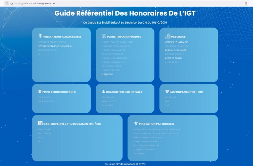
Depuis sa publication au Bulletin Officiel, le 27 décembre 2018, tous les ingénieurs géomètres topographes sont tenus de se conformer aux dispositions du décret portant Code des Devoirs Professionnels et particulièrement l’alinéa 13 de l’article 40 relatif au respect des Normes Techniques de l’Ordre et du Guide Référentiel des Honoraires adopté par le Conseil National, le 10 mai 2019, et mis en ligne via le lien https://guidehonoraires.onigtevents.ma .
La rupture du contrat
La rupture du contrat par l’une ou l’autre partie, ou même de plein droit, peut être prévue par l’insertion de clauses définissant les cas de rupture et le montant des indemnités en fonction de la responsabilité de chacun dans la rupture.
Selon l’article 6 du modèles du contrat préconisé par de l’ordre national des ingénieurs géomètres topographes :
1-  Lorsque le maître d'ouvrage ou ses ayants droit, ou ses ayants cause, décident de résilier d'une manière unilatérale, le présent contrat, il doit acquitter à l'IGT la valeur des prestations réellement exécutées, plus 25% du montant du solde des honoraires des prestations restantes. En contre partie, il reçoit de l'IGT un désistement en bonne et due forme.

2- la clause résolutoire est de droit, en faveur du maître d'ouvrage, après sommation faite à l'IGT, lorsque celui-ci:
        - Diffère, plus que de raison et sans motif valable, à entamer l'exécution des prestations commandées
        - est en demeure de livrer lesdites prestations; le tout s'il n'y a pas faute imputable au maître d'ouvrage.

Dans ce cas, l'IGT est tenu, de restituer les avances reçues.
La résiliation du contrat peut également intervenir d’un commun accord entre les parties, par exemple lorsque le maître d’ouvrage ne souhaite pas poursuivre les travaux par manque de moyens. Un avenant de résiliation doit alors être signé.
Enfin, la résiliation peut être prononcée par un juge. Saisi par l’une des deux parties, le juge constatera que l’une ou l’autre des parties n’a pas respecté ses obligations et prononcera alors la résiliation. Il peut également à cette occasion être saisi d’une demande de dommages intérêts.
Quelle que soit la raison pour laquelle le contrat est rompu, les prestations réalisées au jour de la rupture du contrat sont dues, de même que les éventuels intérêts moratoires dus à cette date.
Exemple de contrat de l’ingénieur géomètre
Les modèles de contrat préconisés par l’ordre national des ingénieurs géomètres topographes se différent selon le nature de prestation, ci-après les deux modèles les plus utilisés :
Vous vouliez savoir plus sur externalisation des travaux topographiques ? Nous espérons avoir répondu à vos questions avec cet article. N’hésitez pas à nous contacter si vous avez la moindre remarque, ou vous avez des questions. Nous vous conseillerons sans engagement.
Pour nous contacter :
– E-mail : [email protected]
– Tel : (+212) 6 60 41 02 18


5 thoughts on “Le contrat de l’ingénieur géomètre topographe : une nécessité pour les 2 parties”